Mount Shasta Eruption History: What Science Tells Us About the Mountain's Violent Past
- October 4, 2026
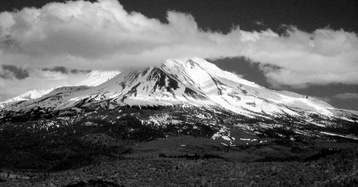
Photo by Randy Siebold via Pexels
Mount Shasta does not sleep quietly. The 14,179-foot stratovolcano anchoring California's Cascades has produced at least a dozen confirmed eruptions over the past 10,000 years, coating surrounding valleys in ash, rebuilding its massive cone through successive lava flows, and reshaping the landscape that today draws visitors to its legendary hot springs. While the mountain has remained silent since the 18th century, the geological evidence buried in the surrounding terrain tells a far more dramatic story.
The United States Geological Survey classifies Mount Shasta as a very high threat volcano, ranking it fifth among the 161 most dangerous volcanoes in the United States based on eruption history, proximity to population centers, and potential impact on aviation and infrastructure. For those who soak in the volcanic-fed springs scattered across Siskiyou County, this ranking carries particular weight: the same geological forces that create geothermal features also built, and continue to shape, one of North America's most magnificent volcanic peaks.
Geological Evidence: Reading the Mountain's Past in Rock and Ash
Understanding Mount Shasta's eruptive history requires reading the mountain itself. Unlike some volcanoes whose ancient activity has been erased by erosion or subsequent eruptions, Mount Shasta preserves a remarkably complete stratigraphic record. Lava flows, pyroclastic deposits, and ash layers stack atop one another like chapters in a book, each telling the story of a particular eruptive episode.
Geologists from the USGS and universities including the University of Oregon and Oregon State University have spent decades mapping these volcanic units, collecting radiocarbon samples from charcoal buried beneath pyroclastic flows, and dating lava flows using potassium-argon and argon-argon methods. Their work reveals that Mount Shasta began its current construction phase approximately 593,000 years ago, building atop an older volcanic foundation dating back perhaps 900,000 years or more.
The volcanic rock itself tells a technical story. Mount Shasta produces predominantly andesitic magma, silica-rich lava that tends to fragment explosively when it encounters groundwater or erupts violently into the atmosphere. This magmatic composition, shared with other Cascades giants like Mount St. Helens and Mount Rainier, means that future eruptions would likely follow patterns similar to those preserved in the geological record: a mix of explosive events that blast ash across wide regions and viscous lava flows that creep down the mountain's flanks at walking pace.
The Four Major Eruptive Periods: Four Distinct Chapters of Construction
Scientists recognize four principal eruptive periods that built the modern Mount Shasta cone. Each period contributed different volcanic products and shaped the mountain's current form in distinct ways.
The Sargents Ridge Eruptive Period
The oldest of these four periods, the Sargents Ridge eruptive cycle, began roughly 300,000 years ago and continued until approximately 9,500 years before present. During this immense timespan, the volcano extruded millions of cubic meters of lava, building the mountain's earliest recognizable cone. The resulting Sargents Ridge formation now forms the mountain's southeastern slopes, exposed as a prominent ridge that drops toward the Shastina lava flow on the mountain's west side.
Eruptions during this period produced both explosive events and effusive lava flows. Pyroclastic flows, superheated clouds of gas, ash, and rock that race downslope at speeds exceeding 100 kilometers per hour, swept across the surrounding terrain, incinerating whatever stood in their path. The deposits from these events now form distinct volcanic units that geologists can trace across the landscape, sometimes finding charcoal remnants that allow precise carbon-14 dating of specific eruptions.
The Sargents Ridge period ended with a major collapse event approximately 10,000 years ago, when a massive landslide stripped away a significant portion of the volcano's northern flank. This debris avalanche, one of the largest known landslides in the Cascades, deposited material across an area exceeding 100 square kilometers and traveled distances up to 11 kilometers from the mountain's source. Such flank collapses are now understood as a normal part of the life cycle for steep-sided stratovolcanoes like Mount Shasta.
The Misery Hill Eruptive Period
Following the Sargents Ridge collapse, Mount Shasta entered its Misery Hill eruptive period, which lasted from approximately 9,500 to 8,000 years before present. This period rebuilt the mountain's northern flank with a succession of explosive eruptions that deposited ash across the regional landscape.
The Misery Hill eruption sequence ranks among the most significant events in Mount Shasta's observable history. Volcanologists estimate the largest single event achieved a Volcanic Explosivity Index rating of 5, placing it in the same category as the 1980 eruption of Mount St. Helens. Such an eruption would have produced a Plinian column towering 25 to 30 kilometers into the atmosphere, spreading fine ash across hundreds of thousands of square kilometers downwind.
Ash from the Misery Hill eruptions has been identified in lake sediment cores from locations as far as 300 kilometers from the volcano, providing scientists with markers that help date surrounding geological features. The eruption produced not only atmospheric ash but also pyroclastic flows that swept down the mountain's flanks, depositing the distinctive Misery Hill Formation that now forms much of the upper northern slopes visible from the town of Mount Shasta.
The Shastina Eruptive Period
Approximately 7,500 years ago, Mount Shasta entered a new eruptive phase centered on a satellite volcanic cone called Shastina. This secondary vent, rising to 12,330 feet on the volcano's western flank, produced a series of massive dacite lava flows that transformed the mountain's western profile.
The Shastina eruptions represent an unusual pattern for Mount Shasta: prolonged effusive activity that produced thick, viscous lava flows rather than explosive fragmentation. Individual flows traveled up to 11 kilometers from their source, ponding in valleys and mantling the lower slopes of the main cone. The resulting lava field now forms the prominent Shastina lava flow, visible as a distinct dark basaltic unit against the lighter-colored andesite of the main summit mass.
Radiocarbon dating of organic material incorporated into these flows suggests the Shastina eruptive period lasted perhaps 200 to 500 years, with the final eruptions occurring approximately 7,000 years ago. Following this activity, Shastina entered a period of dormancy relative to the main cone, though minor activity may have continued at the satellite vent.
The Hotlum Eruptive Period and Continuing Activity
The most recent eruptive period at Mount Shasta, the Hotlum cycle, began approximately 6,000 years ago and continues to the present day, or at least to the 18th century when historical observations become available. The Hotlum vent, located near the summit of the main cone, has produced a series of lava flows and explosive eruptions that built the modern summit dome and contributed material to the upper mountain's steep-sided form.
Eruptions during the Hotlum period include events with Volcanic Explosivity Index ratings of 3 to 4, substantial eruptions capable of producing volcanic columns exceeding 15 kilometers in height and generating pyroclastic flows that would threaten any development within 30 kilometers of the summit. The Hotlum cone itself represents the cumulative product of perhaps a dozen or more individual eruptive episodes, each adding a thin veneer of lava or ash to the growing summit complex.
The Hotlum period is not merely historical. Volcanologists recognize that this eruptive sequence has not ended, the period remains "open" in geological terminology, meaning that future eruptions would be considered a continuation of the same cycle. This distinction matters for hazard planning: the geological record suggests Mount Shasta's eruptions tend to cluster in periods of decades to centuries, followed by similar-length quiet intervals.
The 1786 Eruption: Fact, Fiction, and Historical Evidence
The most recent confirmed eruption at Mount Shasta occurred approximately 238 years ago, documented not in local records, none existed, but in the journal of a French explorer sailing thousands of kilometers away.
In June 1786, the French explorer Jean-François de Galaup, comte de La Pérouse, sailed past the California coast near present-day Monterey. In his published account of the voyage, La Pérouse noted observing a prodigious quantity of smoke rising from a northern mountain, which he identified as Mont St. Joseph. Modern scholars generally agree this refers to Mount Shasta, approximately 400 kilometers north of Monterey Bay.
The La Pérouse observation provides the only historical documentation of volcanic activity at Mount Shasta in the era of written records. However, scientists debate whether this sighting actually represents an eruption. Alternative interpretations suggest the smoke could have been seasonal wildfire smoke, dust, or unusual cloud formations, phenomena that would not constitute volcanic activity. The nearest indigenous populations, including the Shasta, Modoc, and Karuk peoples, left no written records of the event.
The USGS and academic researchers treat the La Pérouse sighting as a possible eruption without confirmation. No tephra deposits or other geological markers have been identified that definitively correlate with a 1786 eruption. What is certain is that no authenticated historical eruptions have occurred at Mount Shasta since the 18th century. The mountain has remained volcanically dormant for more than two centuries, a long interval by historical standards but a mere eyeblink in geological time.
The Current Threat Assessment and Monitoring Network
For visitors drawn to Mount Shasta's hot springs and wild landscapes, the USGS threat ranking may come as a surprise. Ranked fifth most threatening among U.S. volcanoes, behind Kilauea, Mount St. Helens, Mount Rainier, and Mount Fuji due to its proximity to large populations in Japan, Mount Shasta sits in elite company of genuinely dangerous volcanic systems.
The USGS threat assessment incorporates 24 factors, including frequency of past eruptions, likelihood of future activity, proximity to populations, proximity to aviation corridors, and the type of explosive activity the volcano is capable of producing. Mount Shasta's ranking reflects both its documented history of frequent, potentially large eruptions and its location in a region that has experienced significant population growth over the past 50 years.
The USGS Cascades Volcano Observatory in Vancouver, Washington maintains a comprehensive monitoring network over Mount Shasta. This network includes seismic stations that detect the underground rumblings that often precede eruptions, GPS receivers that measure subtle deformation of the volcano's flanks as magma moves underground, and gas sensors that track changes in volcanic emissions.
Satellite-based interferometric synthetic aperture radar provides additional monitoring capability, detecting ground deformation with millimeter precision over periods of years or decades. This technology has revealed that Mount Shasta exhibits a slow rate of surface uplift, approximately 5 to 10 millimeters per year, consistent with the deep accumulation of magma in the volcanic system. Such uplift does not indicate imminent eruption; it simply confirms that the volcano remains geologically active.
For those who soak in the regional hot springs, this monitoring offers a quiet reassurance. The same volcanic heat that warms the mineral springs bubbling from surrounding foothills also powers the deep magmatic system beneath the mountain. Scientists can now detect changes in this system with unprecedented sensitivity, providing days to weeks of warning before any future eruption.
Future Eruption Scenarios: When Mount Shasta Wakes
No one knows when Mount Shasta will erupt again. The geological record shows intervals between eruptive periods ranging from a few centuries to several thousand years, with individual eruptions sometimes separated by decades. The current quiet interval, more than two centuries, falls within the range of previous dormant periods.
However, scientists have modeled several eruption scenarios to inform emergency planning. A typical eruption from the Hotlum cone would likely begin with increased seismic activity and ground deformation as magma moves toward the surface. Steam-driven explosions, similar to those that occurred at Mount St. Helens in 2004 or the ongoing activity at Japan's Sakurajima, might precede any significant eruption, providing additional warning.
The most likely eruption scenario involves a Volcanic Explosivity Index 3 to 4 event, explosive eruptions capable of producing volcanic columns exceeding 10 kilometers in height and spreading ash across the western United States. Such an eruption would pose significant hazards to nearby communities from ash fall and pyroclastic flows, while also disrupting aviation across the Pacific Northwest. Lahars, volcanic mudflows generated when hot ash mixes with snow and ice, could race down the mountain's flanks at speeds exceeding 50 kilometers per hour, threatening the communities of Weed, Mount Shasta, and McCloud.
More extreme scenarios, including larger explosive eruptions or flank collapse events similar to those that occurred during the Sargents Ridge period, are geologically possible but statistically unlikely in any given human lifetime.
For visitors who make the pilgrimage to Mount Shasta's legendary hot springs, whether at the developed pools of Mossbrae or the remote wilderness seeps along the McCloud River, the geological context enriches the experience. These waters emerge because the earth here remains hot, alive, and capable of violence. The same volcanic system that warms your muscles as you lower yourself into the mineral-rich water also built the mountain towering above, and continues its slow, patient work deep beneath the surface.
Mount Shasta will erupt again. When it does, the world will know. Until then, the mountain offers its steaming gifts freely, reminding us that even in apparent quiet, the land beneath our feet remains powerfully, dangerously alive.