Mount Shasta's 1786 Eruption: The La Pérouse Account and the Volcanological Mystery That Endures
- September 16, 2026
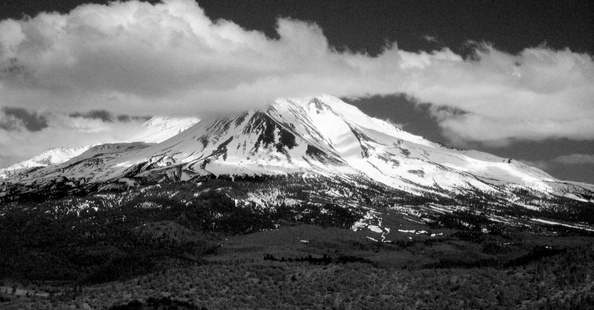
Photo by Randy Siebold via Pexels
On September 14, 1786, French explorer Jean-François de Galaup de La Pérouse recorded what has become one of the most debated observations in the volcanic history of the American West. While sailing the Pacific coast near what is now northern California, his expedition noted a column of fire rising from a tall, snow-capped peak. If La Pérouse actually saw an eruption, Mount Shasta's last major volcanic event happened far more recently than geologists had thought.
The La Pérouse expedition and its Pacific voyage
Jean-François de Galaup, comte de La Pérouse, led a major scientific expedition commissioned by King Louis XVI in 1785. He commanded two warships, the Astrolabe and the Boussole, on a journey meant to finish the Pacific mapping work that James Cook had started a decade earlier. His orders called for detailed records of geography, natural resources, indigenous peoples, and astronomical observations across the Pacific.
The expedition left Brest, France, in August 1785, sailing through the South Pacific, Australia, and New Caledonia before turning north along the Asian coast. By mid-1786, La Pérouse had reached the Pacific Northwest, surveying the coast from Russian territory through Spanish California. This route brought him near the great volcanic peaks of the Cascade Range, including Mount Shasta, which rises to 14,179 feet in northern California near the Oregon border.
La Pérouse had scientific training that made his observations worth attention. Schooled in the methods of the French Academy of Sciences, he recorded what he saw with care and skepticism, often checking his sightings against astronomical positions and dead reckoning. This careful approach gives his mountain observations a certain weight, though it does not settle the ambiguity that has puzzled interpreters for centuries.
What La Pérouse reported seeing
The relevant passage from La Pérouse's journal, recovered and published decades after his disappearance in 1788, describes the sighting in precise terms. On September 14, 1786, while positioned offshore, La Pérouse observed and recorded an extraordinarily tall mountain in the northern California landscape. His journal entry described a column of fire at the summit, visible against the darkening sky. The French naturalist Poissonnier, who traveled with the expedition, also observed the phenomenon and confirmed the account's basic accuracy.
The exact wording of La Pérouse's observation has been translated and interpreted in different ways over the centuries. Some versions emphasize fire while others highlight flames or a burning summit. This distinction matters to volcanologists because different terms suggest different phenomena. A sustained eruption looks different from intermittent fumarolic activity, and both differ from wildfire or atmospheric effects.
Where the expedition was positioned during the observation remains disputed among historians and geographers. Some reconstructions put La Pérouse's ships about 100 miles offshore; others suggest a closer approach. This uncertainty affects how researchers interpret visibility and whether La Pérouse could reliably distinguish between activity at the summit versus conditions lower on the volcano.
The scientific debate: eruption, fumaroles, or fire
Modern volcanologists have split into different camps on the 1786 Mount Shasta observation. Interpretations range from accepting it as evidence of an eruption to dismissing it as a misidentified wildfire or atmospheric phenomenon.
Those who argue for a genuine eruption point to several factors. The timing matches La Pérouse's careful navigational records, letting researchers correlate the observation with specific atmospheric conditions. Some suggest that 1786 may represent Mount Shasta's most recent eruptive event, possibly a Strombolian eruption with intermittent bursts of lava, gas, and volcanic rock. If confirmed, this would place Mount Shasta among the more recently active Cascade volcanoes alongside Mount St. Helens and Mount Rainier.
Other explanations are less dramatic. Summit fumaroles, openings that release gases and steam at volcanic temperatures, still exist at Mount Shasta and could produce visible glow under certain lighting, especially at dawn or dusk when contrast between bright sky and shadowed features creates illusions. The volcano's extensive summit glaciers and snowfield might amplify such effects, making fire appear where none exists. Some researchers have suggested instead that La Pérouse saw a wildfire on the mountain's slopes, perhaps from lightning or indigenous burning practices, which could produce similar effects from 50 to 100 miles away.
Geological evidence and eruption chronology
Mount Shasta's geological record shows massive eruptions throughout the Holocene, with huge debris avalanches and pyroclastic flows reshaping the surrounding landscape. Traditional geological analysis placed the volcano's most recent significant eruptive period at roughly 9,500 years ago, making Mount Shasta appear relatively quiet by Quaternary standards.
More recent research has complicated this picture. Cosmogenic nuclide dating and ice-core analysis have suggested possible eruptions within the last 5,000 years, with some researchers finding evidence of steam-driven eruptions and lava dome growth during the Holocene. The 1786 observation, if validated, would push Mount Shasta's eruptive history into the historic period, a significant change for hazard planning and public understanding of Cascade volcanic risks.
Geological fieldwork on Mount Shasta has documented many volcanic features consistent with relatively recent activity, including unglaciated lava flows and well-preserved volcanic domes. The Sargents Ridge flow and the Chemainus lava flow both show less erosion than older features, suggesting younger dates. But assigning specific ages to these features remains difficult without better dating techniques.
The implications for eruption timelines extend beyond Mount Shasta. More accurate timelines for Cascade volcanic activity help researchers understand how tectonic processes connect to eruptive patterns across the Pacific Northwest.
Indigenous knowledge and oral traditions
The indigenous peoples of the Mount Shasta region, the Shasta, Modoc, Yana, and Klamath, maintain their own accounts of volcanic activity that predate European observation by millennia. These oral traditions, passed down through countless generations, describe events that geological science is only beginning to confirm.
The Shasta people have long spoken of a great fire mountain in their traditional territory. Their narratives describe periods when the mountain breathed fire and shed its skin, language that echoes geological descriptions of eruptions and lava flows. While linking specific events to scientific chronology is difficult, the existence of such detailed oral traditions suggests that significant volcanic activity occurred within human memory on timescales relevant to indigenous history.
The Modoc people, whose territory includes parts of the Mount Shasta area, also keep traditions describing the mountain's volcanic nature. These accounts often weave volcanic activity into broader cosmological narratives, connecting earth processes with spiritual significance in ways that Western scientific frameworks have often overlooked.
Researchers today increasingly recognize indigenous knowledge as a legitimate source of environmental and historical information. Oral traditions require careful interpretation and cannot replace geological evidence, but they offer valuable context for understanding the long relationship between human communities and volcanic landscapes. The persistence of detailed accounts across generations suggests that Mount Shasta's volcanic activity has shaped human consciousness deeply over millennia.
Why this mystery still matters
The 1786 La Pérouse observation remains more than an academic puzzle. For volcanologists, the possibility of a historic eruption at Mount Shasta changes how they assess volcanic hazards. If Mount Shasta erupted as recently as 1786, the probability of future activity rises in probabilistic models, affecting emergency planning, infrastructure decisions, and how officials communicate risk to the public in northern California.
The debate also raises questions about how we interpret historical records. Primary sources require context, and even careful observers like La Pérouse could misidentify phenomena under difficult conditions. Sorting genuine observations from optical or atmospheric artifacts takes collaboration among historians, volcanologists, atmospheric scientists, and indigenous knowledge holders.
For communities around Mount Shasta, the volcanic mystery carries cultural and spiritual weight beyond scientific debate. The mountain remains sacred to indigenous peoples and holds deep significance for the region's identity and economy. Understanding its volcanic history helps build a fuller appreciation of this landscape and human relationships with it over time.
La Pérouse's September 1786 observation remains unresolved more than two centuries later. Whether he saw an actual eruption, a spectacular fumarole display, or a misinterpreted wildfire, his account still challenges researchers working to understand Mount Shasta's volcanic nature. The mystery persists because it matters to scientists mapping the Cascade Range's eruptive history and to anyone who recognizes that understanding the past shapes how we relate to the living earth beneath our feet.